A short description from
Britannica:
From an early age d’Anville continued the reform of French cartography begun by Guillaume Delisle, but he was also a reputable classical scholar, and many of his memoirs and maps relate to ancient and medieval geography. He displayed exceptional judgment in his choice and use of past authorities and a detailed knowledge of measures of distance, and he adjusted his measurements where possible to astronomically determined positions. His first important map was that of China, prepared from the surveys of the Jesuits. First issued in 1735, it later was published as the Nouvel atlas de la Chine (“New Atlas of China”) in 1737. His map of Italy (1743) corrected numerous errors in the accepted maps of that country. Other important maps were of Africa (1749), Asia (1751), India (1752), and the world in hemispheres (1761). From the contemporary map of Africa, d’Anville removed many of the conventional and largely fictitious features of the interior, and his representation stood until the great explorations of the 19th century. His Atlas général, first published in 1743, was frequently revised. D’Anville was appointed first geographer to the king of France in 1773.
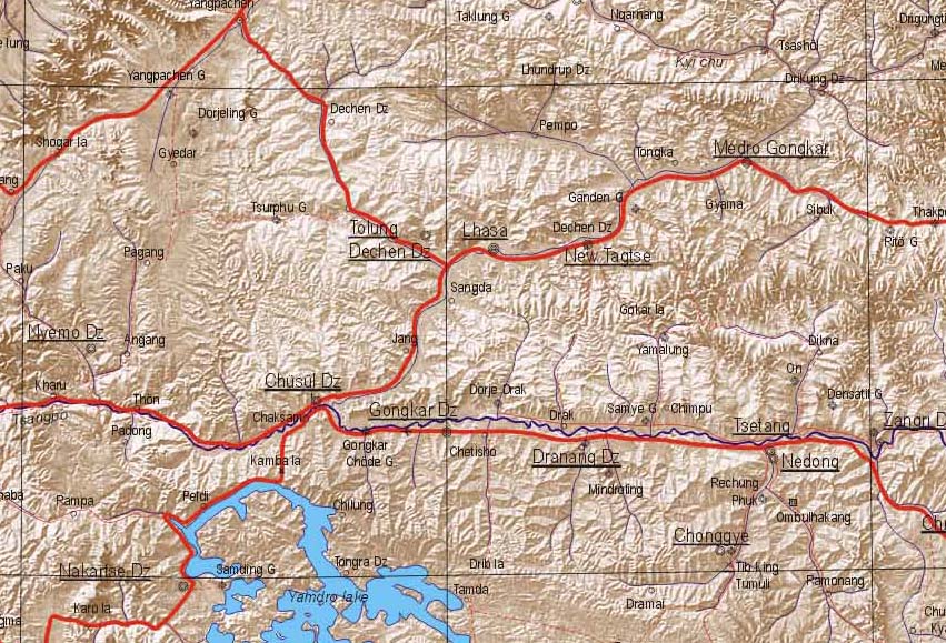
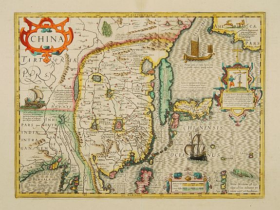
Despite their lack of converts, the Jesuits played a major role in making Tibet better known to the West. For instance they provided information for Father Du Halde’s monumental description of the Chinese empire published in Paris in 1735. The Library holds rare early French and English editions of this book. The maps to accompany Du Halde’s works were included in J.B.B. d’Anville’s Nouvel atlas de la Chine, de la Tartarie chinoise et du Thibet (New atlas of China, Chinese Tartary and Tibet). D’Anville was the Royal Geographer of France, and his 1737 atlas remained the standard geographical source about China and adjacent territories for many years. The maps were prepared during a lengthy survey of the Chinese Empire ordered by the Kangxi emperor in 1708. The fieldwork was carried out by Chinese, with some supervision by the Jesuits. This was the first atlas to depict Tibet and its districts.
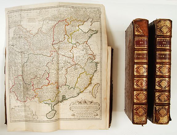
The Library has recently acquired a rare 1785 edition from a specialist bookseller in Canberra.

Book for sale:
Volume IV: With a large folding map of China/Tartary and a map of Corea (The first separate map of the peninsular). Maps of Tartary and Tibet.
Du Halde's beautifully printed and splendidly illustrated work is the summation of European knowledge on China in the 18th-century. It was begun by the Jesuit missionaries to China in 1708, and their completed manuscripts were presented to the Emperor Kang-hi in 1718. Kang-hi ordered further surveys and from them were constructed the well-known maps forwarded to father Du Halde and used by d'Anville for this work.
Because the principles and methods of surveying had greatly improved by the late 17th- and early 18th-centuries, the result was the most accurate mapping of China available in Europe at the time.
The maps are by Jean Baptiste Bourguignon d?Anville (1697-1782), ?the finest cartographer of his time? (Moreland & Bannister: Antique Maps, p.133).
For certain remote parts of northern China, Mongolia and Tibet, this work was the only adequate reference until the technological revolution in surveying in the 20th-century.
 Larger image of atlas.
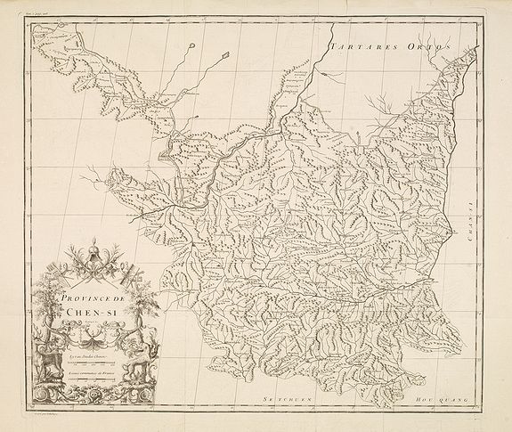
Publisher: ANVILLE, J.B.D'
Title: Province de Chen-Si.
Published in: The Hague, 1737
Size: 18.2 x 21.0 inches.
46.2 x 53.4 cm.
Colouring:
Uncoloured.
Condition: A very good and dark impression.
Condition Rating: 2
With a quite elaborately pictorial cartouche, engraved by Guélard, the map by Delahaye.
Jean Baptiste Bourguignon d' Anville (1697-1782), French cartographer. Compiled over 200 maps. This map is from his most important work Nouvel Atlas de la Chine, published in The Hague 1737, The principal cartographic authority on China during the 18th century. (Tooley)
D'Anville used maps prepared by Jesuit missionaries and commissioned by Emporer-Kanyx, who in 1708-16 ordered a surveying of the country. This map is the first accurate cartographic depiction of this area available in the western world.
Included in Description de la Chine by P.du Halde.